Category: Historical Maps

  • Historical Maps

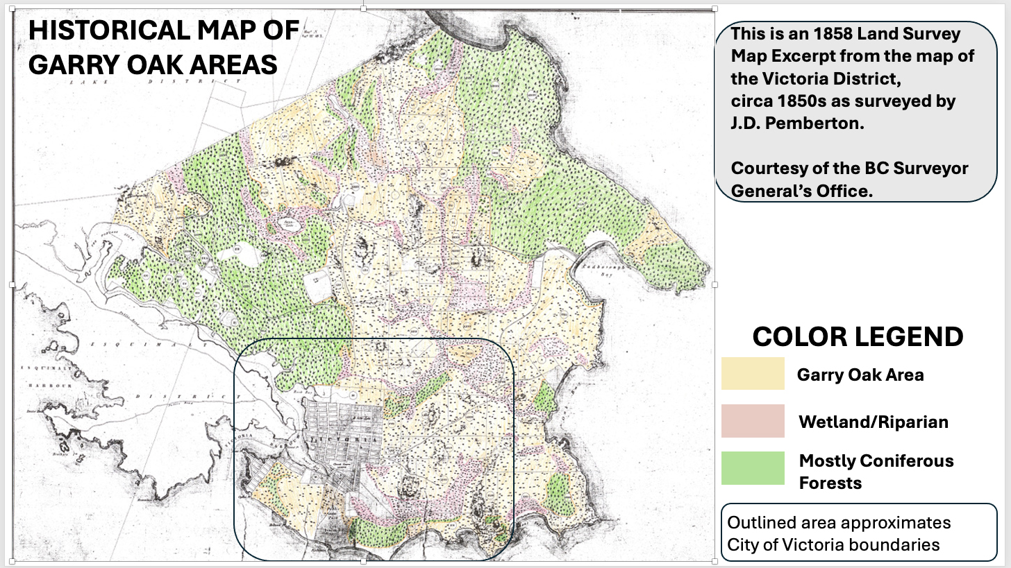
    The urban area of the City of Victoria is the Garry oak ecosystem (GOE)–– a fact often left out of discussions on the urban forest. The Garry oak ecosystem, or Kwetlal food system in the ləkwW əŋən language, has been shaped by Indigenous agroecological management for thousands of years and emerged after the glacial retreat around 10,000 years ago. Prior to European settlement, most of the land now within the City of Victoria (with the exception of the shorelines and the low-lying riparian areas), supported the Garry oak ecosystem. The open woodland character resulted from millennia of ləkwW əŋən land management and harvesting. In the absence of these activities, the landscape would be dominated by closed stands of Douglas-fir and Grand fir.

    The Garry oak (GO), a long-lived keystone species, currently supports over 1,645 co-evolved species of plants, insects, amphibians, reptiles, birds, and mammals, making its preservation crucial. GO and associated ecosystems in this region have a unique local genetic adaptation would be difficult to re- introduce if lost. With continued intentional inputs drawing from ləkwW əŋən knowledge, human and non- human populations may continue to benefit from this highly adaptable and long-lived plant community.

    Screenshot
    Screenshot

    GARRY OAK ECOSYSTEM – WHAT REMAINS

    AreaYear 1800 (Ha)Year 1997 (Ha)
    Victoria1,46021
    Oak Bay85025
    Saanich3,473192
    Central Saanich7407
    Sidney300
    North Saanich1, 0401
    Esquimalt47020
    Colwood32016
    Langford370105
    View Royal27039
    Metchosin1,18049
    Indian Reserves24037
    Total10,443512

    Source: GOERT, http://goert.ca