Category: Community Mapping
-
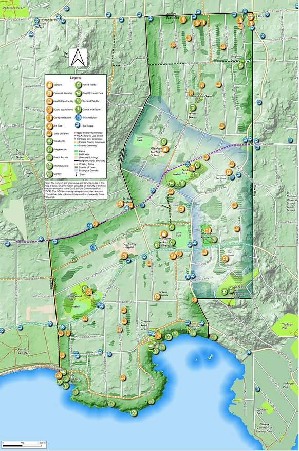
Gonzales Community Green Map
In 2018, the Gonzales Neighbourhood Association (GNA) initiated a community mapping exercise in cooperation with the University of Victoria – Geography Department. Seven years later, they are proud to announce that the Community Map is finished. The 2025 map includes a proposed migration corridor that links the ocean environment found at the Gonzales Observatory with the protected Read more
-
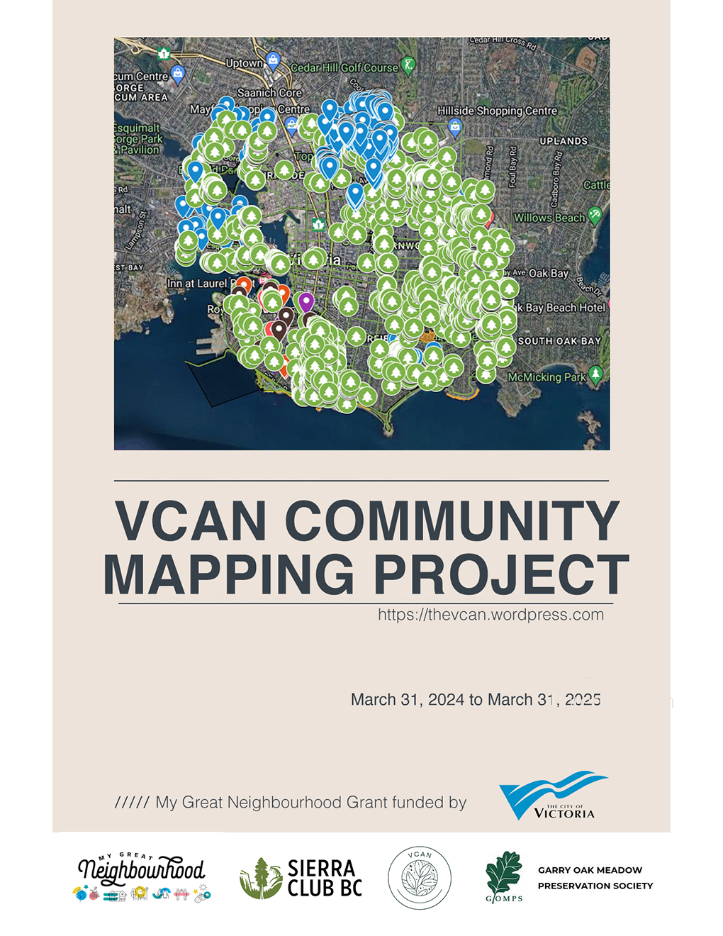
VCAN Community Mapping Project
A conversation about the distribution of biodiversity within and between the City of Victoria’s neighbourhoods. To complement the City’s excellent inventory of all trees on public land, the Victoria Community Association Network (VCAN) has involved each neighbourhood in an inventory of Garry oaks and other elements of biodiversity on private property. Each neighbourhood developed their Read more
-
Dear Developer: Invitation template
Document published through the VCAN Community Mapping Project (Appendix “Dear Developer: Invitation template”) The scale of land use changes in the City of Victoria created a discussion by the VCAN Mapping Team on how start a conversation about the Garry oak ecosystem with market actors like builders and developers. The City of Victoria’s Tree Protection Read more